The Lexington Bicycle Map
|
DISCIPLINES Geography Urban Planning GIS Architecture Cartography |
OVERVIEW
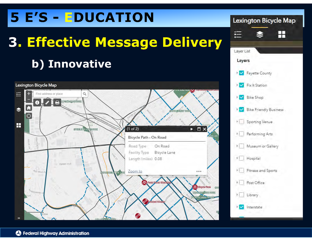
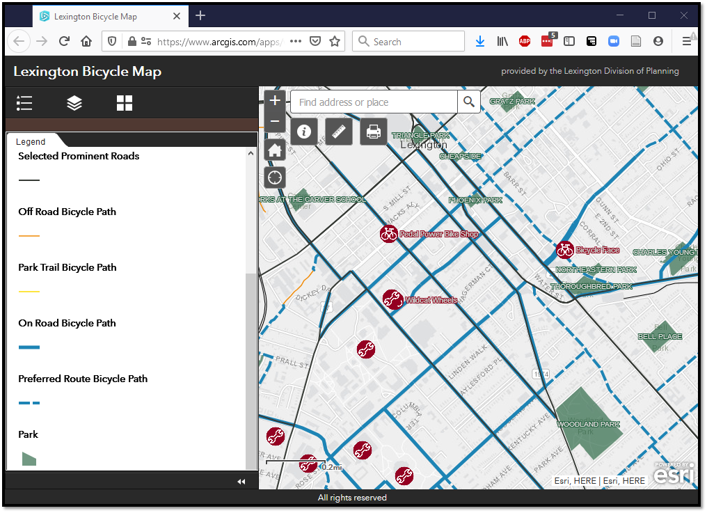
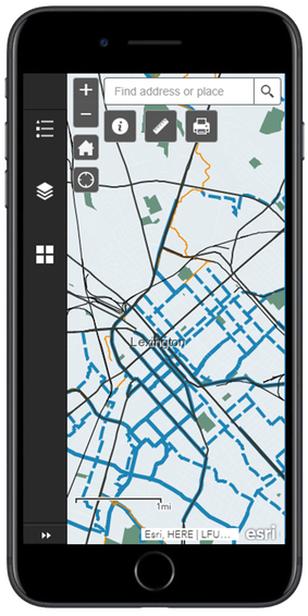
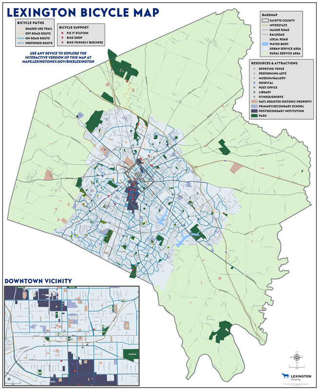
In 2020, Lexington celebrated it's 100th mile of bicycle paths; the time had come for a new bicycle map. This web-based bicycle map is responsive to various devices, from phones to desktops. Robust functionality means that users can toggle layers, choose their favorite basemap, locate themselves, find paths to points of interest, measure distances, draw routes, export pdfs, and more; check out the Tutorial Video below for a complete demonstration.
|
|
|
The Bicycle Map can be browsed in the embedded version below, is best viewed in a separate web browser at maps.lexingtonky.gov/BikeLexington, and can be downloaded as as a large pdf for printing.
Web Based Map
Wall Map
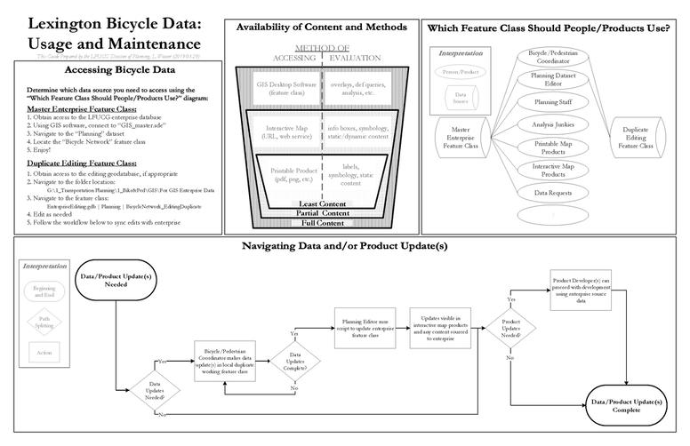
Sources
Map Layers
LFUCG Planning Division LFUCG GIS Services Point of Interest Symbols Cricket Press Basemaps Esri |
|
Soft SkillsCollaboration
Delegation Innovation Project Management |
This web-based bicycle map was created primarily by L Well. Weaver, Senior Planner at LFUCG. Without the groundwork and critical collaboration with Scott Thompson, Bike/Pedestrian Senior Planner, the delivery of this data would certainly not have been possible. The technical infrastructure and enthusiastic support from the LFUCG GIS team bring this work and much more from a dream to a reality.
Production Date: 2020.05
Acknowledgements from the Federal Highway Administration
The FHWA's comprehensive approach focuses on the 5 Es: Engineering, Education, Enforcement, Encouragement, Evaluation. This map was acknowledged for innovative, effective message delivery.