Bicycle Map Functionality Demo
|
DISCIPLINES Geography Urban Planning GIS Architecture Cartography |
OVERVIEW
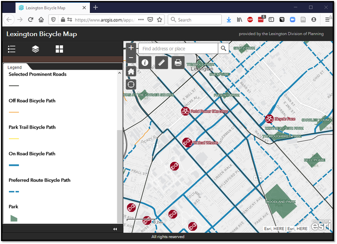
The 2020 Lexington Bicycle Map is loaded with robust functionality. A lot of information and interactivity can be overwhelming. This video gives an overview of the functionality to point users to the tools that they will need most from route creation to selecting the layers that are of most interest.
|
This video demonstrates functionality in the 2020 Lexington Bicycle Map.
Content is conveyed in categories: responsivity, zoom, layer, locate, measure, print, resources.
Content is conveyed in categories: responsivity, zoom, layer, locate, measure, print, resources.
SoftwareArcGIS Desktop
ArcGIS Online Web Services Adobe Photoshop Active Presenter |
Hard Skills
Visualization
Map Development Application Development Video Development Documentation |
Soft SkillsCollaboration
Communication Innovation Presentation Project Management Strategy Writing |
The 2020 Lexington Bicycle Map was a collaborative project with the LFUCG Metropolitan Planning Organization and the LFUCG GIS team. This video was created solely by L Well. Weaver to convey the functionality of the web-based map for optimal use by community members.
Production Date: 2020.06