Lexington Historical Timeline Poster
|
DISCIPLINES Geography Urban Planning Cartography Research |
OVERVIEW
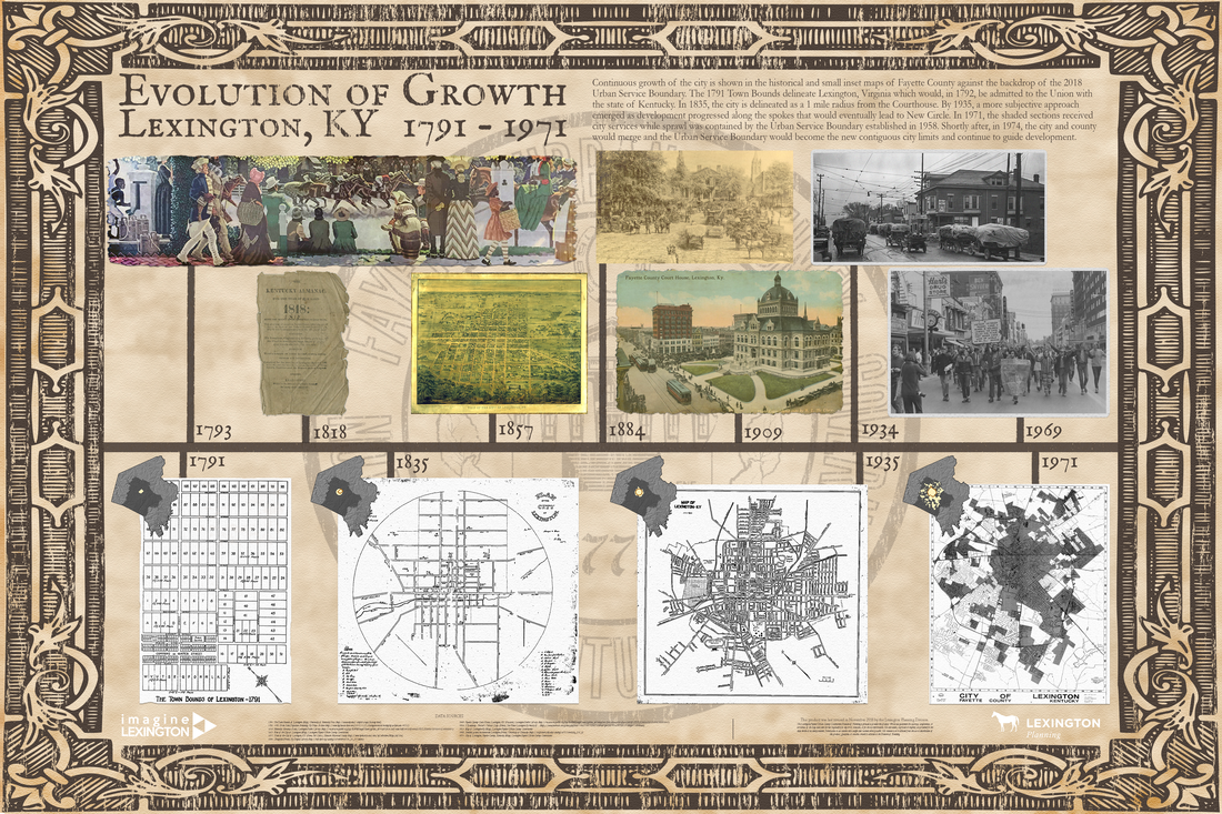
To move forward, we must look back. This large wall poster features maps from different times in Lexington's development from the Town Bounds of 1791 to the Urban Area of 1971. Digitized documents from numerous rich archives are featured along the top of the timeline providing onlookers with a concept of how it felt to exist within the maps on the timeline below.
|
|
Hard Skills
Visualization
Map Development Data Mining/Collection Data Management Data Processing Data Validation Documentation |
Soft SkillsCollaboration
Communication Presentation Project Management Research |
This poster created by L Well. Weaver, Senior Planner and the talented Grace Coy, Planning Technician during time working together with LFUCG Planning.
Production Date: 2018.12
Webinar on Lexington History
Enjoy this webinar with experts on history and development of historical properties.